Dan Mahr
Entry-level knowledge worker positions, such as the venerable GIS analyst, often have a narrow set of career paths. One can move up into project management and/or personnel management. But that usually means doing less of the geospatial problem solving that got you interested in GIS in the first place!
Another commonly suggested path is to learn to code. Programming requires constant problem solving, and the huge demand for developers and engineers means that salaries are generous. In addition, the post-pandemic world means that companies are suddenly more amenable to remote workers from anywhere in the United States. But how would you actually go about making this career change?
I recently had the privilege to be a guest on the Mapscaping Podcast and discuss how I pivoted from GIS analyst to software engineer. This blog post offers some additional details to anyone considering a similar pivot.
Go For A Test Drive
Upon hearing of the huge salaries that Silicon Valley software engineers rake in, some folks want to immediately quit their jobs and jump feet first into a master’s program or a coding bootcamp. This is the kind of moxie and gutsiness that America was built on…right? Wrong.
Make sure you actually enjoy programming before committing to costly education.
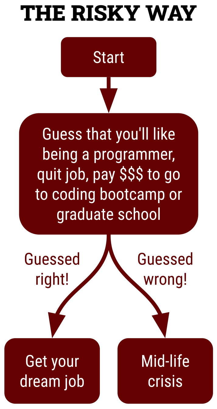
Let’s do a thought experiment. Pretend you’re in the market for a used car. You find something with low mileage from a brand with a reputation for reliability. However, it’s listed on Craigslist so it lacks a warranty. Moreover, the seller refuses to let you test drive or even see the car before you put down a deposit. Would you send a wire transfer sight unseen? Definitely not: only a fool would be so rash! For the same reason, only a fool would dive into a master’s program or bootcamp without going for a proverbial “test drive” beforehand.
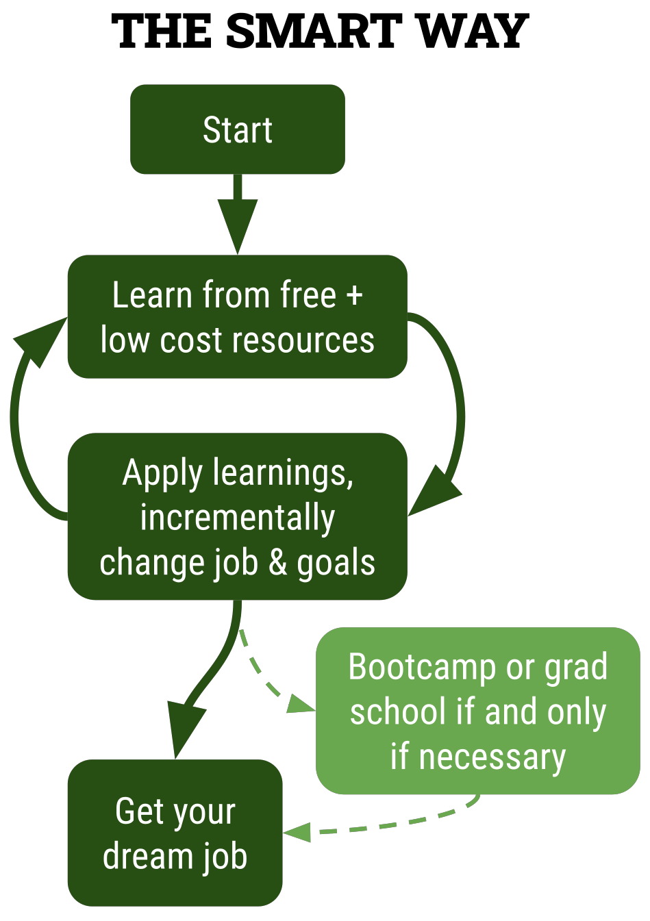
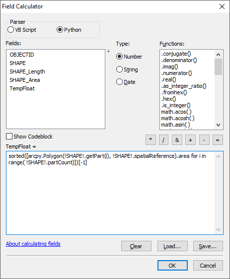
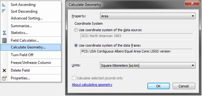
The best way to test drive whether you like programming is to use it in your current job. Much of the day-to-day busy work of knowledge workers can be enhanced, made more efficient, or perhaps completely automated through some kind of programming:
Continue reading Pivoting from GIS analyst to software engineer